
Let me first say that the indigenous people who inhabited most of the outer Cape Cod, the Paomet and Nauset, settled here 10,000 years ago. More on them in another blog, since now I want to clear up what Europeans were here first.
When we think of Spanish conquistadors, we think of Caribbean, Mexico and South America, not the northern Atlantic shoreline of Canada and U. S. Did you know that Estêvão (Estevan) Gomes, explored and mapped from the North American coast for the Spanish crown a century before the Mayflower landed? He named Cape Cod “Cap de las Arenas” (Cape of the Sand Dunes). (Morison 33

Estêvão (Estevan) Gomes (1483 – 1538)
Estevan Gomes was a pretty interesting guy. Born in northern Portugal in 1483, some accounts say that Gomes was Black. He was a sailor in his homeland during his youth and moved to Spain as a young man. In 1518, he was appointed an official Spanish ship pilot by the Casa de Contratacion, Spain’s office of overseas affairs in Seville. In 1519, Gomes sailed with the Magellan expedition as the pilot major of the fleet aboard the San Antonio. His real ambition, however, was to become captain of the ship. Gomes frustration grew when he was passed over for promotion in favor of Magellan’s inexperienced nephew, Alvaro de Mesquita. Near the Strait of Magellan, Gomes overpowered Mesquita, took control of the San Antonio and sailed back to Spain in May 1521. Upon their return, Gomes claimed his mutiny was justified by Magellan’s abuses and poor management. The mutineers were thrown in jail while their claims were investigated, but within six months all except Mesquita were freed.[3] (Wikipedia)

https://upload.wikimedia.org/wikipedia/commons/6/6b/Detail_from_a_map_of_Ortelius_-_Magellan%27s_ship_Victoria.png
in 1524 and 1525, with the Spanish king’s blessing, he set out searching for the Northwest Passage — a sea route connecting the Atlantic and Pacific oceans — but did not find it. It was because of Gomes’s charts of his exploration of major North American rivers and other landmarks that Diogo Ribeiro, another Portuguese cartographer living in Spain, was able to draw an outstanding outline of the East Coast.
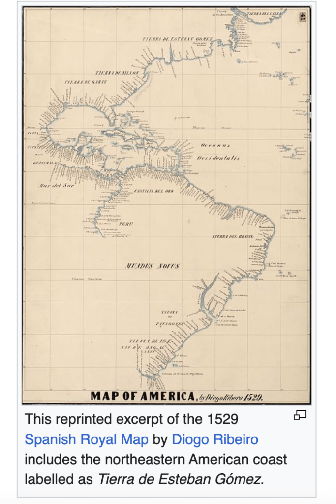
Published in 1529, Ribeiro’s hand-drawn world map prominently identified America’s northeastern region as “Tierra de Estevan Gomez,” indicating that it belonged to Spain. And Europe followed this map for most of the 16th century and part of the 17th. It was eventually displaced by other maps created following the British conquest of New England. www.creators.com/read/miguel-perez/
This is another clear example of the conquerors being able to write history to their liking, erasing what came before. It seems wherever we go, there is some truth to find about what really happened, of which I will be sure to write.

Actually Cape of Sands. Sand Dunes are “dunas de arena”
LikeLike